|
The TECHBASE
Oil and Gas Package plots down hole data and maps, and stores
your data in a TECHBASE database. Composite and locates
your data within boundaries, then you can choose between 7 modeling algorithms
to interpret your surface and subsurface data.
Comprehensive Oil and Gas Software Packages
are available for $8050.00 US |
|
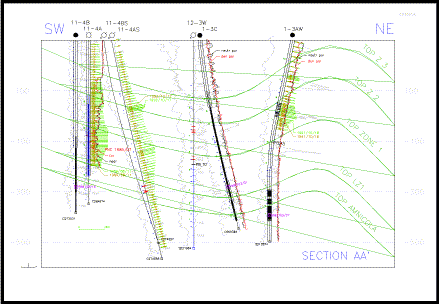
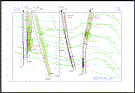
Cross Sections |
|
|
|
|
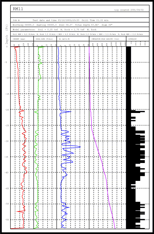
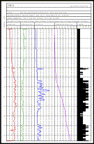
Logs |
|
|
|
|
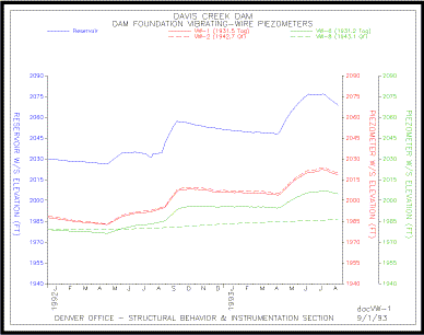
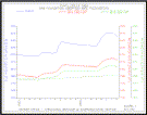
Statistics and Graphs |
- Summary statistics
- Correlation and Regression analysis
- Cumulative frequency plots
- Duplicate Data Analysis
- X-Y (Scatter) Plots
- Histograms
- Time Series Diagrams
- Ternary Diagrams - Triangular
Plots
-
Click here for more graphs
|
|
|
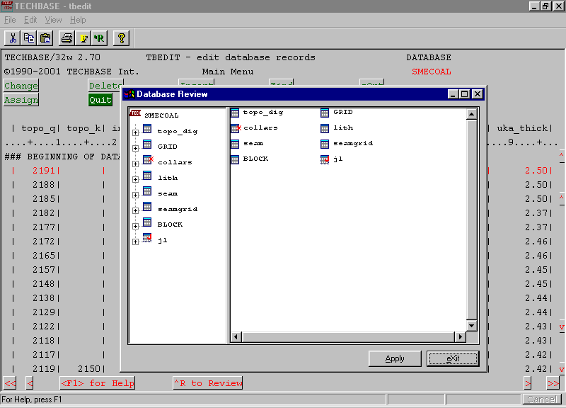
Data Storage |
- Store surface and subsurface
data in a TECHBASE Database
- Define your own data parameters,
limits, type, perform inter-record calculations
- Special fields designed for
subsurface data
- Full filtering, searching, validating
capabilities
- Connect to ODBC compliant databases
- Load data from outside sources
or enter directly into TECHBASE
- Create reports of data in full,
subsets, averages, totals and more
|
|
|
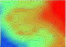
Data Modeling |
- Composite (average) down hole
data into intervals, rock types, benches or user defined variables
- Choose from 7 modeling algorithms
(Inverse Distance, Kriging, 2D Polygon estimator, 2D Trend Surface
estimator, 2D Triangulation estimator, 2D Minimum Curvature,
2D Contour to Grid interpolation) plus Variography.
- Populate 3D block tables or
2D cell tables using TECHBASE modeling algorithms
- Locate data within boundaries
such as land ownership limits
|
|
|
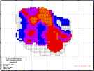
Mapping |
- Basemaps
- Topographic Maps
- Maps of monitoring wells
- Plot multiple values adjacent
to wells, sample locations
- Geologic Maps
- Drill Hole Location Maps
- Land Maps
- Maps of Land Features
-
Click here - view more maps
|
|
|
Additional Capabilities |
- Digitize Data into TECHBASE
using the sDigit program
- Contour modeled or raw (XYZ)
data
- Interactively edit graphics
- add title blocks, move points etc.
- Convert data from one coordinate
system to another "on the fly' while creating TECHBASE
graphics
- Print graphics or save to a
variety of transportable formats
- 6 months of technical support
included in purchase
- Self-paced tutorial included
in purchase
|
|
Productivity |
|
Add a productivity Module: create tasks using the TECHBASE
Technicn program to automate:
- Cross-section, log, map creation
- Create tasks for any TECHBASE
module
- Combine tasks into organized
steps
- Create input screens for use
by non-technical personnel
- Limits = your imagination!
- Available for an additional
$585
|
 |
|
Expansion |
|
Need more tools? Don't buy
another software package, you can purchase additional
TECHBASE modules to perform tasks such as:
- Slope stability analysis
- Groundwater modeling
- Coordinate Conversion
- I-Power Converters
- IHS Translators
- And Much Much more!
For more information on TECHBASE
modules, visit our Product
Detail Page or
Contact us. |