|
TECHBASE software allows the user to define many
aspects of map formatting including scale, limits, graphics features
(line weight, color etc)., contour characteristics and more.
Please do not hesitate to
contact
us if you have any questions about the capabilities of any
TECHBASE mapping programs.
|
|
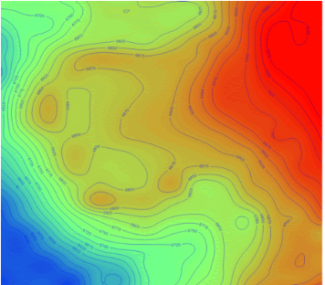
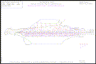
Color Filled Contours |
|
Contour maps can be color filled based on
user defined color series. This map shows a topographic map that has
been filled using a blue to red spectrum. Similarly, contour maps of any
surface feature which can be gridded, can be color filled. |

|
|
Complex Layers |
|
Combine data from multiple sources,
land maps, contour maps, surface features, geochemistry - you
name it - into complex maps that beautifully summarize your data
for reports, presentation or just as a work product. No need
for multiple software products or databases, TECHBASE
stores all your data, analyzes this data and plots it too - what
more could you want? |
|
|
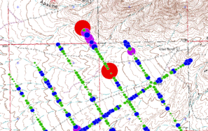
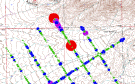
Vector Maps |
|
Vectors can be plotted, along with
user defined variables that track time of map creation, fields
plotted, database filters etc. as shown on this example. |
|
|
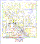
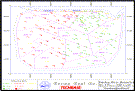
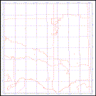
Drill Hole Location Maps and
Land Maps |
|
Basemaps can include whatever data
you decide is important. Drill hole locations, land boundaries
and limited geographic references are shown on this map of a
coal property. |
|
|
Bubble Plots |
|
TECHBASE offers many plotting options for your data. This
example shows a 'bubble plot' where the size of the marker corresponds
to the geochemical value of the surface soil sample. You may
also choose to plot different symbols, alter the color of the
maker and even create your own custom markers. |
|
|
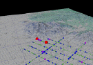
3D Bubble Plots |
|
When you really need to impress someone
with your geochemical data, consider constructing a 3D bubble plot. As
with the TECHBASE plan-view bubble plot maps, each circle can be
constructed to represent relative value of your data point. These values
can also be color coded, with colors and cutoffs you designate for your
project. |
 |
|
Contour Maps |
|
Multiple contoured surfaces can
be combined to produce very effective graphics as in this example
of piezometric data from a land use map. The use of different
line weights, colors and fonts can combine to give the user an
accurate picture of multiple data sources and their relationships. |
|
|
Coordinate Conversion |
|
The TECHBASE coordinate conversion
utility converts all your location data from one coordinate system
to another. Or you can select to convert data 'on the fly' as
you are plotting it on your maps. This allows you to quickly
plot and compare data, or combine data from multiple sources. |
|
|
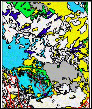
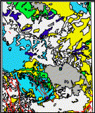
Geologic Maps |
|
Complex
geologic maps can be constructed
from your surface data. Geologic outcrops can be digitized directly
into TECHBASE using our SDIGIT program. Or, use
external or internal polygon files to construct geologic maps.
Color fill, patterns or both define geologic units. You can then
add any of your other data - such as land boundaries, grids,
contours, geochemistry or drill hole collars to your map. |
|
|
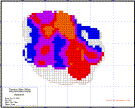
Bench Maps |
|
As your project progresses, bench
maps of your block modeled data may be useful. Shown are color-coded
blocks that correspond with the ore values plotted inside each
block. Polygons, such as open pit boundaries, or perhaps land
ownership, can be plotted on these maps as shown by the outline
of the modeled pit in this diagram. |
|
|
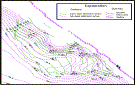
Expansion |
|
Need more capabilities? No need
to buy another software package. Add TECHBASE modules
to:
- Model your data into 2D surfaces
and 3D blocks
- Calculate tonnages and volumes
- View your data with our 3D viewer
- spin, rotate, zoom and pan through your project area producing
stunning graphics
- Simulate pit slopes and topography
- Model groundwater flow
- And much, much more
|
|
|