| Sets the Standard | ||
|
TECHBASE combines a comprehensive database manager with quality graphics,
essential statistics, and powerful modeling tools to create a complete
software package. This easy-to-use software effectively meets the needs of
engineers, geologists and scientists.
With TECHBASE, professionals can go beyond mere data storage to complete analysis and understanding. Join colleagues around the world using TECHBASE in such fields as |
||
|
|
 |
|
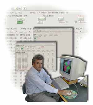
Technical Database |
||
Technical data is
different! TECHBASE is designed to easily and effectively store, analyze
and present technical data. TECHBASE has many unique features and
capabilities to help get results and bring any project under control!
Why TECHBASE? It gets the job done. It is cost effective. It is flexible. From initial data collection - from any source - to ultimate goal. Put the unrivaled flexibility of TECHBASE to work on your project! |
|
|
|
|
||
|
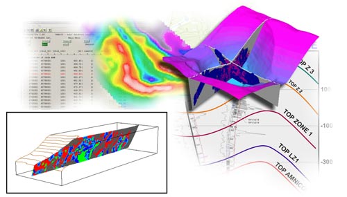
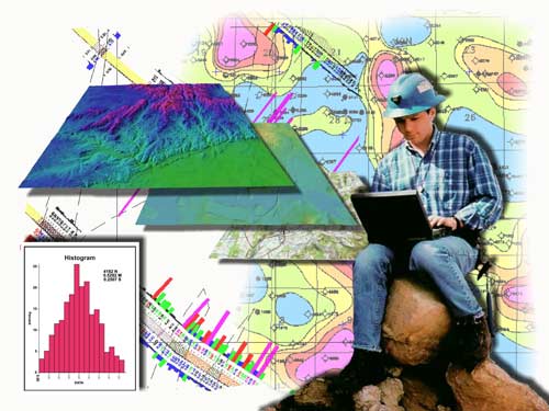
Quality Graphics |
||
TECHBASE graphical
capabilities are exceptional! You can easily bring hidden information to
light. The flexible graphics deliver visualization that inform and
impress management, colleagues, and clients alike.
|
|
|
|
Powerful Modeling |
||
|
TECHBASE modeling programs provide the most powerful and complete 2D, 2.5D and 3D estimation tools available. You can select the modeling technique best suited for each individual project and data type. Modeled results are stored in the database, making readily available for the further analysis.
|
|
|
|
|
||
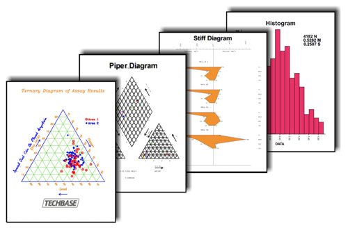
| Essential Statistics | ||
TECHBASE pays close
attention to data quality. The statistics programs are the basis for
validating, verifying, and ensuring data integrity. In order to get
results you can trust, you must believe in the soundness of the data.
|
|
|
|
|
||
| Productivity Tools | ||
|
TECHBASE can be
customized efficiently and effectively. Our TECHNICN program is the key
to customizing TECHBASE for maximum productivity. Imagine producing
solutions at the touch of a button, from base maps and cross-sections,
to volumetrics and complete resources estimation.
TECHBASE can be customized to fit your individual requirements, and keep as those requirements change |
||
|
|
||
| Customer Driven | ||
|
From day one, TECHBASE International has supported clients in manner to which few are accustomed. No matter how remote your location, no matter how complex your problem, TECHBASE International strives to get answers to you quickly. We have the industry's most knowledgeable, highly trained staff. You work hard, we work hard. Our technology enables you to contact us 24 hours a day… every day! Our commitment to our customers includes complete turnkey installation and customization services. This minimizes the time required to make TECHBASE an effective part of your organization.
|
||
|
|
||
|
|
||
|
(C) Copyright
TECHBASE® International 1996-2013. All rights reserved. |
||